

























UK Weather Turns Unsettled as Met Office Flags Flood Risk Into September
After a record-breaking summer of heatwaves, the Met Office says unsettled conditions and heavy showers are bringing a renewed flood risk across parts of the UK.

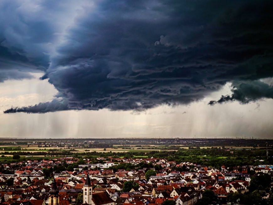
From record heat to renewed rain risk
Britain's weather is undergoing a dramatic shift as summer draws to a close, with forecasters warning that a spell of extreme heat has given way to a far more unsettled pattern bringing heavy showers, thunderstorms and an increased risk of flooding. The change follows what has already been described as a remarkable summer for temperature records.
Earlier this month, temperatures provisionally reached 38.1°C at Kew Gardens in London, making it the fifth hottest day ever recorded in the UK. The Met Office noted that 2026 had by that point seen more days reaching or exceeding both 36°C and 37°C than any other year on record, while also equalling 2022 for the number of days that hit 38°C. Chief Forecaster Neil Armstrong described the heat spell at the time as the latest instalment in what had already been an exceptionally dry and record-breaking season across much of England and Wales.
A sharp change in direction
That extreme heat has since faded, replaced by a markedly different weather regime. The Met Office has been actively pushing back against speculation of an imminent return to sweltering conditions, instead pointing to a more turbulent outlook. Officials say the dominant signal for the remainder of August is an unsettled pattern, featuring frequent showers, spells of rain, and temperatures generally close to seasonal averages rather than another significant heat spike.
Forecasters have specifically flagged the risk of heavy and potentially thundery showers, particularly across northern and central England, with hail also possible in some areas as low pressure dominates the pattern through much of the coming week. The shift illustrates how quickly UK weather can swing between extremes within a single season — a pattern that climate scientists say is becoming increasingly common as the climate warms.
Untangling the headlines
The rapid change in conditions has fuelled a wave of conflicting weather headlines, ranging from warnings of a looming cold snap to speculation about a sixth heatwave arriving as late as September. The Met Office has taken the unusual step of directly reviewing some of these claims against its own forecasting data, in an effort to cut through public confusion.
While the Met Office's outlook does acknowledge that temperatures may trend above average at times heading into September, it has been careful to stress that this is a different proposition to the kind of sustained, intense heatwave conditions seen earlier in the summer. The distinction matters for households, event organisers and local authorities all trying to plan around genuinely uncertain short- and medium-range forecasts.
The flooding concern
Of greater immediate concern to many communities is the flood risk associated with the shift to wetter conditions. After weeks of dry ground baked hard by record heat, sudden heavy rainfall can run off quickly rather than soaking in, increasing the likelihood of localised and surface water flooding even from relatively modest rainfall totals. Areas that experienced the driest conditions during the summer heatwave may now be among the most vulnerable to rapid flash flooding when the rain does arrive in force.
Environment Agency teams are understood to be monitoring the situation closely as the unsettled pattern develops, a routine but important precaution given how quickly conditions can escalate from isolated showers to more significant flooding events, particularly in urban areas with limited drainage capacity.
What residents should expect
For now, the message from forecasters is one of caution rather than alarm: expect a changeable and often wet end to August, with the possibility of some warmer interludes but no clear signal of another major heatwave in the immediate term. Anyone with outdoor plans over the coming days is being encouraged to check the latest local forecasts regularly, given how quickly showers and thunderstorms can develop under the current unsettled pattern.
Longer term, the swing from record-breaking heat to flood risk within a matter of weeks serves as a reminder of how volatile the UK's weather has become — a trend that scientists continue to link to the broader effects of a changing climate on the jet stream and storm tracks affecting the British Isles.
What's Your Reaction?
 Like
0
Like
0
 Dislike
0
Dislike
0
 Love
0
Love
0
 Funny
0
Funny
0
 Angry
0
Angry
0
 Sad
0
Sad
0
 Wow
0
Wow
0